Low Visibility Imaging Technologies for Remote Tower Operations
Infrared and thermal sensors can detect hazards that defeat the human eye in darkness and fog.

Low visibility imaging technologies are not a substitute for the human eye in remote tower operations. They are a measurable improvement over it. Infrared, thermal, and high-definition sensor arrays allow controllers to detect hazards in darkness, fog, and degraded conditions that would defeat unaided observation from a conventional cab, and that advantage matters most at the airports that currently have no controller watching at all.
Why conventional tower cabs fail in the conditions that matter most
A control tower cab depends on unaided vision, aided at best by binoculars, and that dependency becomes a safety liability the moment lighting or weather degrades. The limitation is structural rather than procedural. No amount of training compensates for the physics of human vision in fog, rain, low cloud, snow, or darkness. A controller who has spent decades in a cab remains subject to the same optical constraints as anyone else looking through that window, because the window itself is the instrument, and the instrument has fixed limits.
The failure is most acute during instrument flight rules conditions. When visibility collapses, a controller's independent information about aircraft position degrades to whatever pilots choose to report over the radio. The controller becomes dependent on self-report rather than observation, which inverts the fundamental relationship that air traffic control exists to maintain. The pilot becomes the source of the traffic picture instead of its subject, and the controller loses the separation between observer and observed that the entire system is built upon.
Fixed cameras in conventional towers compound rather than solve the problem. They provide partial views, often unclear, and they are not integrated with tracking, zoom, or augmented data overlays. A camera feed mounted on a bracket is still just a window, smaller and sometimes worse than the glass beside it, and it asks the controller to divide attention across disconnected displays rather than to fuse information into a single coherent picture. The conventional cab, even with cameras bolted on, remains what it has always been: a physical room whose observational power is capped by weather, light, and the geometry of the building itself.
What a remote tower sensor stack actually consists of
A remote tower's sensor array is not a single camera substituting for a window. It is a layered stack of complementary technologies, each addressing a different failure mode of unaided vision. The design logic is the same one that governs any serious sensor system: no single modality sees everything, so the architecture combines modalities whose strengths and weaknesses do not overlap.
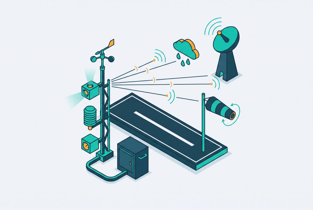
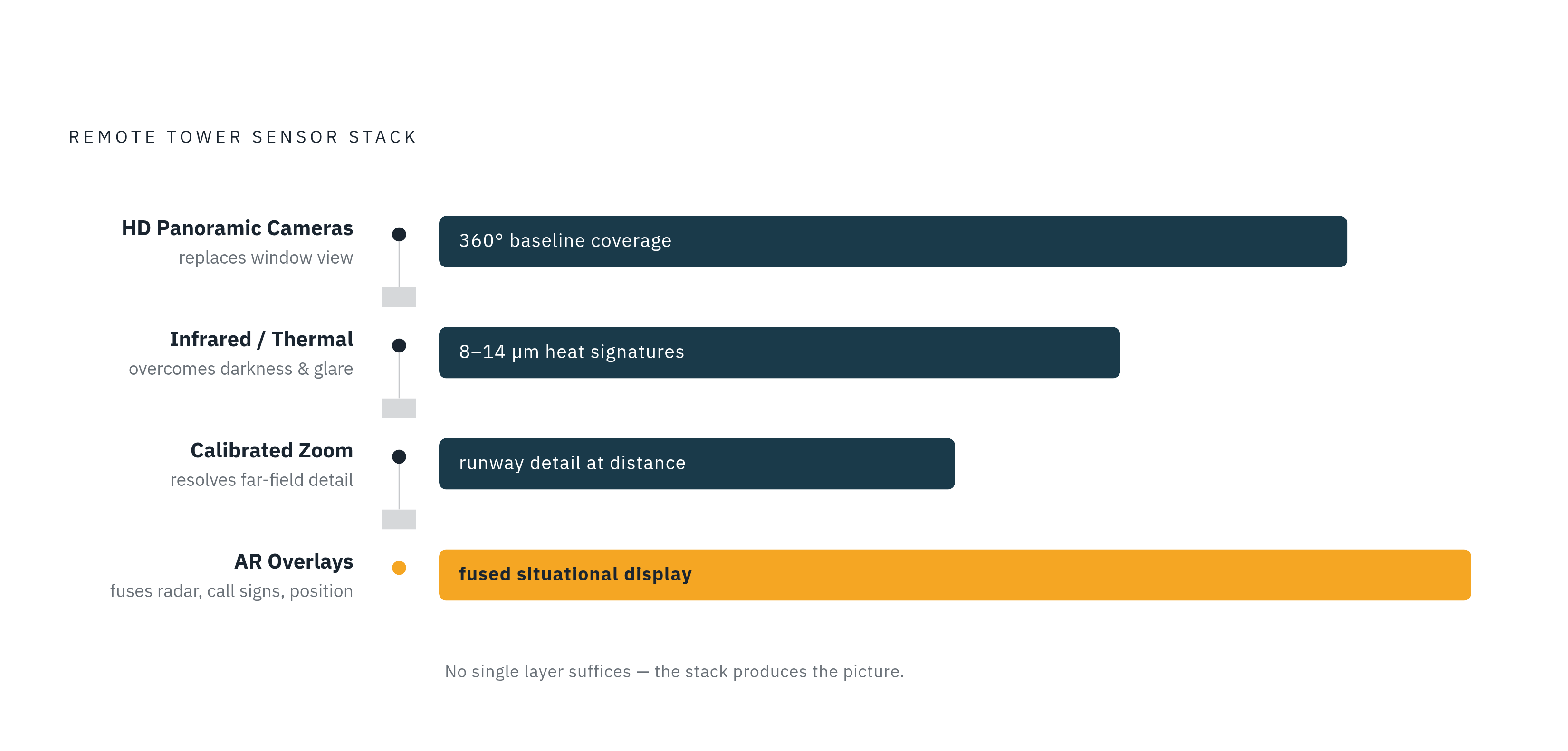
High-definition cameras provide the panoramic baseline, a 360-degree real-time view of the airfield and its surroundings displayed on panoramic screens in the remote operations room. This replaces the windows, but it does more than replicate them, because the view is captured from positions chosen for surveillance value rather than from wherever a cab happened to stand. Infrared and thermal sensors detect heat signatures independent of ambient light. Aircraft engines, exhaust plumes, and even large wildlife emit thermal signatures that HD cameras cannot resolve in darkness or heavy precipitation. The core operating principle of thermal imaging is detecting radiation in the 8–14 µm long-wave infrared spectrum based on heat rather than reflected light, which means its performance is largely decoupled from ambient lighting and only moderately affected by fog and precipitation that scatter visible wavelengths. The patent record specifically identifies infrared cameras as part of the solution architecture for low-visibility ground traffic monitoring, alongside augmented reality overlays delivered via head-mounted display.
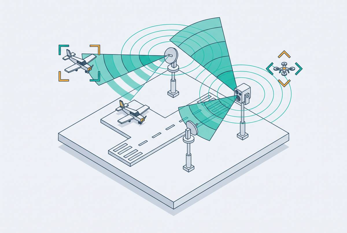
Around these imaging layers, the stack adds the machinery that turns video into surveillance. Calibrated zoom capabilities allow controllers to resolve detail at runway distances that would require binoculars in a cab, without leaving their display position or interrupting their scan. Object tracking ties the visual feeds to positional data, so an identified aircraft or vehicle is followed automatically rather than located manually on each pass. Augmented reality overlays inject radar tags, call signs, and operational data directly onto the video image. The controller sees a fused picture, not raw video that has to be cross-referenced against a separate radar display. Each layer answers a specific weakness of the human eye, and the stack is designed so the layers compensate for each other's limits.
How sensor fusion gives controllers information the human eye cannot produce
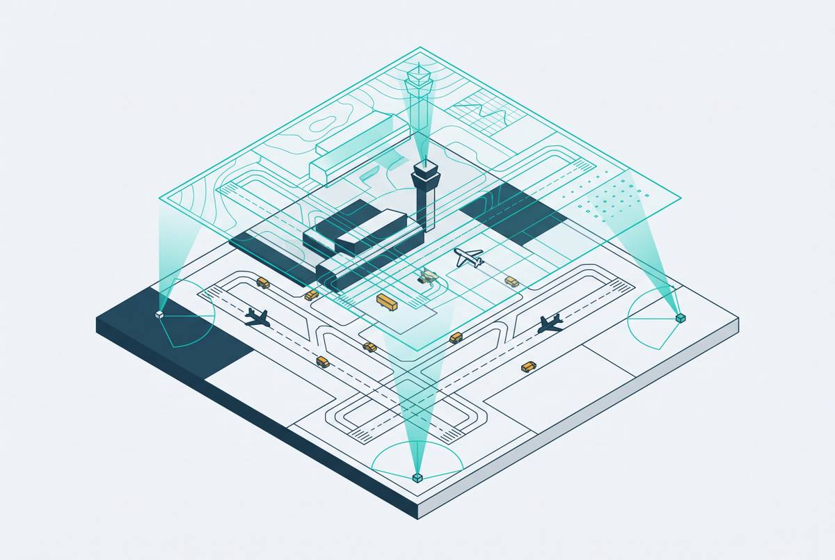
The power of the stack lies in combination, not in any individual sensor. When infrared, thermal, HD, and tracking data are fused into a single controller display, the result is a situational picture that exceeds what any human observer in a physical cab can assemble, even in good conditions, and decisively so in bad ones. The improvement is not incremental. It changes the category of information available to the controller, from uncertain and pilot-reported to independently observed and continuously updated.
The contrast is sharpest at night. Thermal and infrared feeds reveal aircraft, vehicles, and wildlife that are invisible to the naked eye. A controller in a remote center can detect a deer on a runway that a cab controller would not see until it was too late to act. In fog and precipitation, visible-light cameras degrade along with the human eye, but infrared imaging continues to resolve heat-emitting objects through moderate fog, so the sensor stack maintains partial surveillance when the cab goes effectively blind. At long ranges, zoom capability resolves runway detail at distances where cab binoculars require the controller to stop scanning and physically locate the instrument, while the remote display zooms without interrupting posture or scan rhythm.
The continuous panoramic coverage removes another class of failure. A remote controller's screen does not require head turns, and the system has no blind spots created by structural columns or cab geometry. The 360-degree display is always present. A foundational study of digital tower performance found that such a system could provide better surveillance at night and in instrument flight rules conditions including rain, fog, and snow. That finding matters because it is not a laboratory extrapolation. It is the empirical statement of what the sensor architecture does: it restores independent observation to the controller precisely when the conventional cab loses it.
The objection that sensor-enhanced awareness introduces its own situational awareness risks
The honest case for remote towers must acknowledge that replacing the physical cab with a digital environment creates new human-factors challenges that the sensor stack alone does not eliminate. A peer-reviewed study cited in the research record raises the concern directly: while remote tower technology reduces construction and operation costs, its digital and virtualized working environment poses new challenges to controllers' situational awareness. The concern deserves to be taken at full weight.
A controller accustomed to ambient cues, engine noise, wind, the physical sense of aircraft proximity, loses those inputs in a remote center. The sensor stack replaces some but not all of them. Latency in video feeds, however small, is a qualitatively different input from direct observation, and in high-tempo moments even brief lag changes the timing of controller responses. The strongest form of the objection is the over-trust scenario: a controller who relies too heavily on the sensor stack and underweights its failure modes, camera obstruction, sensor dropout, display lag, may be less cautious than one who knows visibility is poor and acts accordingly. A cab controller in thick fog knows the limits of the view and compensates. A remote controller staring at a clean fused display might forget that the display itself has limits.
The counterfactual, however, is decisive. A cab controller in genuine IFR has no sensor stack at all, so the situational awareness deficit there is not a new risk to manage but an existing and unaddressed one. The remote environment introduces manageable failure modes, and the same systems that surface the challenge also carry the tools to mitigate it: redundant sensors, system health monitoring, alert overlays. That mitigation is an active topic in the human-factors literature, not an afterthought. The tradeoff favors the sensor-equipped remote environment, but only when the design and training treat the digital environment's limits as seriously as the conventional cab's.
Why these capabilities matter most at the airports that currently have no tower at all
The all-weather imaging advantage of a remote tower sensor stack is most consequential at the airports that now operate with no air traffic control coverage, where degraded-visibility hazards go completely unobserved. The scale of the unaddressed population is substantial. The United States has roughly 527 towered airports against a far larger number of non-towered landing facilities, and the vast majority of the National Airspace System operates without any tower, remote or conventional. At a non-towered airport in fog or after dark, there is no controller at all. Not a cab controller with limited visibility, but no controller observing the surface. A deer on the runway, an aircraft that has drifted onto an active surface, a vehicle that has crossed a hold-short line: none of these trigger any alert, because there is no one watching.
The conventional tower's cost makes it structurally unavailable to this population. The Reason Foundation's May 2025 report documents that construction costs for remote towers are a fraction of those for conventional towers, and that when several low-activity airports are controlled from a single remote tower center, significant staff and operating cost savings follow. The remote tower center model, one facility managing multiple airports, is the economic mechanism that makes the sensor stack affordable at airports with low traffic counts, because the capital cost of the imaging infrastructure is amortized across a portfolio of airports instead of being borne by a single facility.
The FAA's own April 2026 RFP, number 693KA8-26-T-00016, for Remote Tower Systems for the NAS specifically targeted rural, small community, and non-towered airports, with emphasis on system deployment, operational support, and performance validation. The agency has identified this population as the deployment priority, and the solicitation confirms it in procurement language. The airports that need all-weather imaging most are exactly the ones that have never been able to afford any tower at all.
What operational deployment looks like and what the U.S. certification path requires
Remote tower sensor stacks have moved from research to operational service internationally, but U.S. deployment at scale depends on a certification process that has not kept pace with the technology's maturity. The operational record is no longer in question. Örnsköldsvik Airport in Sweden has had all air traffic control operations conducted remotely from Sundsvall since the first remote tower went into operation in Sweden in 2015, over a decade of continuous service. London City Airport has been fully controlled by remote ATC from Swanwick in Hampshire, 115 km away, since 2021, a major international airport demonstrating that the sensor stack performs at scale and in demanding airspace. The Reason Foundation report records 41 remote towers in operation, under development, or in active planning globally according to the IFATCA database. International adoption has moved well past the proof-of-concept stage.
In the United States, the constraint is procedural rather than technical. The FAA System Design Approval process is the formal certification required before a digital or remote ATC tower system can operate in the NAS, and the research record describes it as expensive, long, and cumbersome. The FAA has emphasized the higher complexity of the U.S. airspace system as context for the slower pace, and the complexity is real. The counterpoint, documented in the same source, is that dozens of small U.S. airports have relatively simple, low-volume operations that could benefit immediately from this technology without requiring the full complexity of large-airspace certification.
Policy momentum is building in ways that matter concretely. Legislation signed in July 2025, H.R.1, the One Big Beautiful Bill, allocated funds specifically to establish a clear approval process for remote towers and deploy them at non-towered airports as part of a broader ATC modernization package, and the April 2026 FAA RFP signals active procurement intent. The gap between international operational maturity and U.S. certification progress is real, but it is narrowing. The sensor technology itself is not waiting. Imaging capabilities validated in operational service abroad are available for U.S. deployment once the regulatory pathway is cleared.
How the sensor stack enables capabilities beyond current ATC, including UAS integration
The same imaging and sensor infrastructure that gives remote towers an all-weather edge also provides the surveillance foundation that uncrewed aircraft system integration into the National Airspace System requires. The sensor stack's value compounds as airspace complexity grows, because the investment is not tied to a single regulatory outcome or a single class of traffic. UAS integration into the NAS requires persistent, low-altitude surveillance at airports that currently have no ground-based observer, and that is exactly the surveillance gap the remote tower sensor stack fills. The detection problem that has blocked routine uncrewed operations at small airports is the same problem that remote imaging solves for conventional traffic.
The capability transfer is direct. Thermal and infrared sensors that detect wildlife and aircraft in darkness are the same sensors capable of tracking UAS traffic in the low-altitude environment around an uncontrolled airport. Object tracking and augmented reality overlays, already part of operational remote tower deployments, are the display-side infrastructure needed to present mixed crewed and uncrewed traffic to a controller managing a small airport. The remote tower center model also supports workforce flexibility: controllers certified across multiple airports in a single center can shift attention as traffic demands, providing coverage that a small airport with no tower cannot currently access at any price.
For the small and non-towered airport, the sensor stack is not a single-purpose tool. It is infrastructure that pays for itself across low-visibility safety, routine ATC coverage, UAS traffic management, and future advanced air mobility operations simultaneously. The investment case strengthens with each new use the infrastructure absorbs, because the capital cost of the imaging equipment does not rise with the number of functions it serves. The sensors that see a deer on a runway at midnight are the same sensors that will locate an uncrewed delivery vehicle in the pattern at noon. That durability is what makes the case for deployment compelling beyond the immediate safety argument, and it is why the technology is unlikely to remain confined to the airports that already have towers.