Machine Vision Detection Accuracy Across Deployed Remote Tower Systems
AI-powered camera arrays must match human perception for remote tower safety.
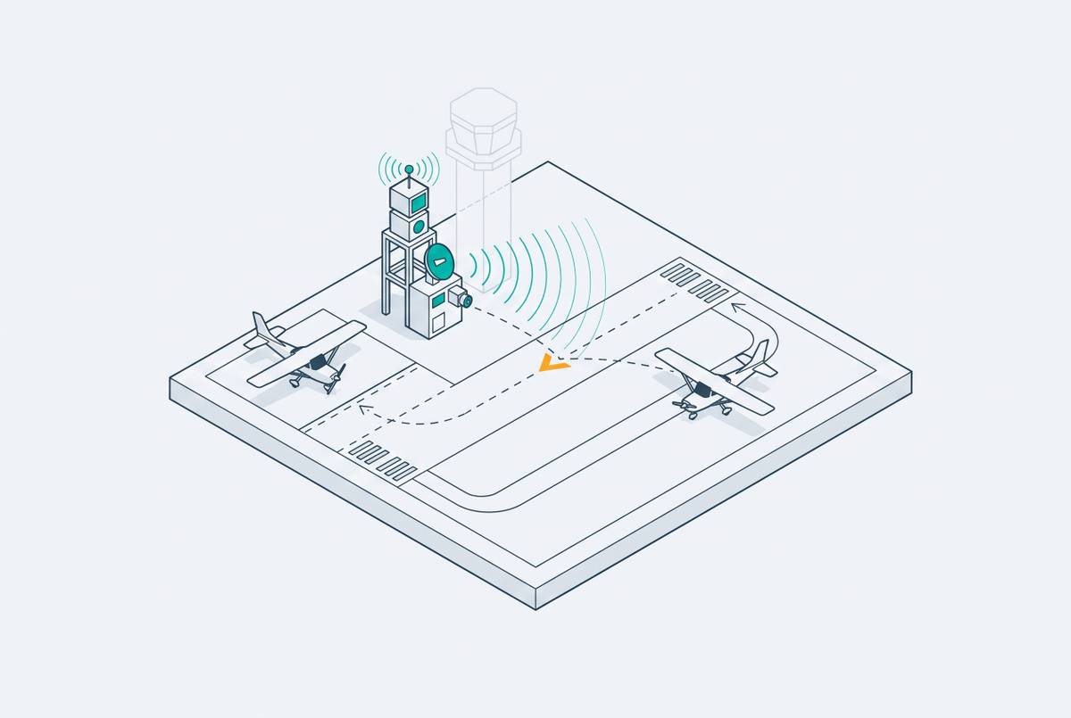
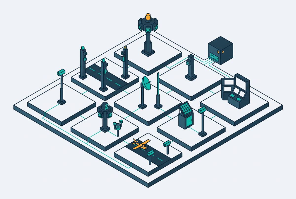
A remote tower works as an ATC tool only if its machine vision layer can detect, track, and present aircraft, vehicles, and personnel with enough accuracy to stand in for a controller's own eyes. Treating it as a video relay misreads what the system is built to do. A Remote Tower Service gives aerodrome ATC or Flight Information Service from a location other than the aerodrome, at a safety level equal to a physical tower, and it relies on real-time streams from arrays of fixed and moveable HD cameras at the airport itself. The architecture has two main components: sensors at the airport and controller working positions at a remote center, linked by a secure data network. Machine vision sits at the sensor layer, but what it produces is the entire basis for what the controller sees and acts on. Simple closed-circuit video cannot autonomously track aircraft, vehicles, and personnel, nor can it generate the real-time data analysis, predictive insight, and automated alerts that an AI-powered vision system produces. That distinction sets the threshold this entire piece examines: a remote tower has to match, not approximate, what a controller physically present would perceive.
Camera array design shapes detection from the start
Before any algorithm runs, the camera array itself already determines how much the system can see. Resolution, coverage geometry, and sensor mix set the raw material the AI layer has to work with, and no amount of downstream processing recovers detail that was never captured. London City Airport makes the scale of a real deployment concrete: the system uses 16 HD cameras feeding a panoramic moving image across 14 HD screens that together cover the entire airport. That is an engineered coverage system rather than a single lens pointed at a runway. If the feed of a distant runway threshold is low-resolution, it stays that way no matter how capable the detection model downstream is.
Physical towers always had to solve a sightline problem, and array geometry has to solve that same problem now, just optically instead of structurally. San Francisco International's tower needed to reach 221 feet to secure unobstructed sightlines across its field, and digital arrays now have to answer that same geometry constraint with camera placement and field-of-view planning instead of concrete and steel. The constraint is the same; only the solution has moved from architecture to optics. Each airport's runway layout, traffic mix, and obstructions mean the array has to be designed from scratch for that site, so detection accuracy is never a single fixed number across installations. It is a property of each array design.
The AI tracking layer turning a camera array into an ATC detection tool
This is where raw video turns into usable situational awareness. It identifies object classes, assigns tracks, and generates alerts on its own, and the trustworthiness of that output is what controllers and regulators ultimately have to stand behind. The core job is tracking aircraft, vehicles, and personnel, three object classes that differ in size, speed, and movement pattern, each needing its own tuned detection approach. Deep learning architectures built for industrial inspection lines turn out to share a common ancestry with the ones used airside: YOLOv5 is in active use for airside object detection, the same family of model used widely in manufacturing and logistics vision systems.
What a controller actually works from, real-time position tracks, runway incursion alerts, automated warnings, comes out of this AI layer, not out of the cameras themselves. The cameras supply pixels. The tracking layer supplies meaning. These systems do more than identify what is on the airfield right now; they can also predict what happens next, and that matters directly for conflict detection on final approach or during runway crossings.
None of this works unless it happens fast enough to matter. Near-real-time presentation means image capture and display have to happen with latency under one second, so whatever inference the AI layer performs has to fit inside that budget. So processing has to move toward the sensor site itself instead of a distant cloud server; that is the same edge-versus-cloud logic long established in industrial machine vision, where real-time inference runs locally and only training and model management move to the cloud.
Detection accuracy: fog, compression, and the limits of visible-light sensing
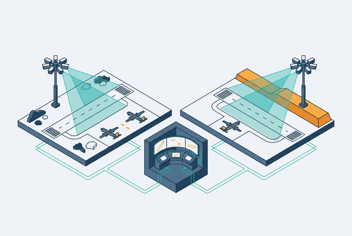
Fog is the most damaging single condition a visible-light camera array faces, because it degrades detection through several mechanisms at once: reduced image contrast, attenuated structural detail, and partial occlusion of the scene. Each of those hits object localization and recognition directly, and the effect compounds when the target is distant or small, as it is when an aircraft nears the far threshold of a runway in low visibility.
Fog degrades detection at the algorithm level too. Detectors commonly miss targets or return low-confidence predictions in dense fog, and YOLOv5 specifically suffers mis-detections and false positives caused by the atmospheric scattering that fog particles produce. That is a measurable failure mode in a model family already in active airside use, not a hypothetical weakness.
A second, unrelated degradation pathway comes from the data link itself. Blurring, pixelation, or JPEG compression from the data link can also reduce what controllers see on digital video, and this happens even in clear conditions, apart from any weather-related degradation. Fog is an atmospheric problem; compression is a transmission problem. Rain degrades visible-light cameras the same way, through reduced contrast, and at night visible-light detection stops working unless another sensor type fills the gap.
None of this is a rare edge case. Low visibility at airports already affects airside capacity and the rate of runway and taxiway incursions. It is precisely the condition under which detection accuracy has to hold, not the condition it can be allowed to fail under. If the AI has to run an additional defogging or image-enhancement pass before it can even attempt detection, the sub-one-second display budget becomes much harder to meet.
Sensor fusion as the primary engineering response to detection gaps
Combining visible-light cameras with infrared and other sensor types is the leading engineering answer to the weather-driven failures described above, but it is applied unevenly across deployed systems, so the detection capability on offer varies meaningfully from one installation to the next. Infrared penetrates conditions that defeat visible light outright, so controllers working from digital remote towers with infrared cameras see better in rain, fog, or at night than controllers in a conventional tower relying on the naked eye.
This is not a laboratory promise. Infrared integration is already deployed in real systems, and it opens up a documented operational advantage over conventional towers on night and low-visibility performance. Adoption is not uniform: one deployed system includes infrared cameras, and another does not, a concrete illustration that sensor fusion has not yet become a universal standard at this early stage of remote tower rollout. That has a direct consequence for how detection accuracy claims should be read. If two remote tower systems use different sensor configurations, a figure quoted for one may not transfer to the other, because the hardware layer shapes what any such benchmark actually measures. The field's standing recommendation is to combine multiple sensor types, because no single sensor type covers every condition on its own, and doing so reduces detection errors and strengthens operator decision-making.
Radar offers a second fusion pathway distinct from infrared. In simulated instrument flight rules conditions, remote digital tower systems showed an advantage because radar and high-resolution displays, already in wide use, can supply position data that does not depend on camera visibility at all. Fusing these streams is not free. You have to time-synchronize and spatially calibrate multiple sensor feeds before the AI layer can merge them into one coherent track, and that extra engineering work adds both cost and latency to the pipeline.
Latency as a detection accuracy variable that operates independently of image quality
Accuracy in an ATC context is not only about whether the AI correctly identifies an object. If a correctly identified aircraft reaches the controller's display one or two seconds late, that is operationally equivalent to a missed detection at the exact moment a runway conflict develops. Latency and image quality are separate axes of the same problem, and a system can fail on either one even while succeeding on the other.
The sub-one-second budget has to absorb every step in the pipeline: image capture, compression, transmission across the data network, decompression, AI processing, overlay generation, and final display. Each stage adds its own delay, and the total has to stay under that threshold for the system to count as near-real-time. The data network connecting the sensor site to the remote center is a variable the airport does not fully control, and it can add delay under heavy load or a degraded link. Compression shortens transmission time but reintroduces the blurring and pixelation that degrade detection accuracy in the first place, so the trade-off has to be actively managed rather than resolved once and left alone.
Edge computing removes the network round-trip that causes latency. Running AI inference at the sensor site itself, instead of at the remote center or in a cloud environment, removes a network round-trip from the detection pipeline entirely, the same principle that already drives edge deployment in industrial machine vision. You can see the stakes of getting this wrong in simulated instrument flight rules conditions, where controllers have to rely solely on pilot reports for aircraft location. A latency failure in a remote tower's display system recreates that exact degraded state for a controller who is supposed to have a technological advantage over it, not a reversion to it. That is the safety equivalence requirement from the opening section, expressed as a timing constraint rather than an image-quality one.
The global deployment record on system performance at scale
The deployments with the strongest operational track record are in Scandinavia, where controlling multiple airports from a single remote center has moved from pilot project to routine service. Örnsköldsvik Airport in Sweden became the first airport in the world managed remotely, in 2015, establishing the proof of concept the rest of the industry has built on since. London City Airport followed in 2021, becoming the first major international airport fully controlled by a remote, digital tower, using the 16-camera, 14-screen panoramic array described earlier.
The multi-airport model matters specifically for detection accuracy, because a single remote center handling several airports at once means the AI tracking and alert systems have to perform reliably across different runway layouts, different traffic mixes, and different environmental conditions, not just one carefully optimized installation.
The U.S. picture is earlier-stage. As of May 2025, the FAA was testing a system at Atlantic City International in New Jersey but had not certified it for use in the National Airspace System. The FAA Reauthorization Act of 2024 directed the agency to define a system design and operational approval process and to publish milestones for testing and deployment of remote and digital towers, but that system design approval has not yet been published. The evidence shows that prototype runway-incursion detection systems have not been tested at scale under adversarial real-world conditions, fog, compression artifacts, latency spikes, unfamiliar object types, in U.S. airports, and that gap in validation is the strongest objection to remote tower detection claims.
The safety gap at uncontrolled airports that detection accuracy must ultimately close
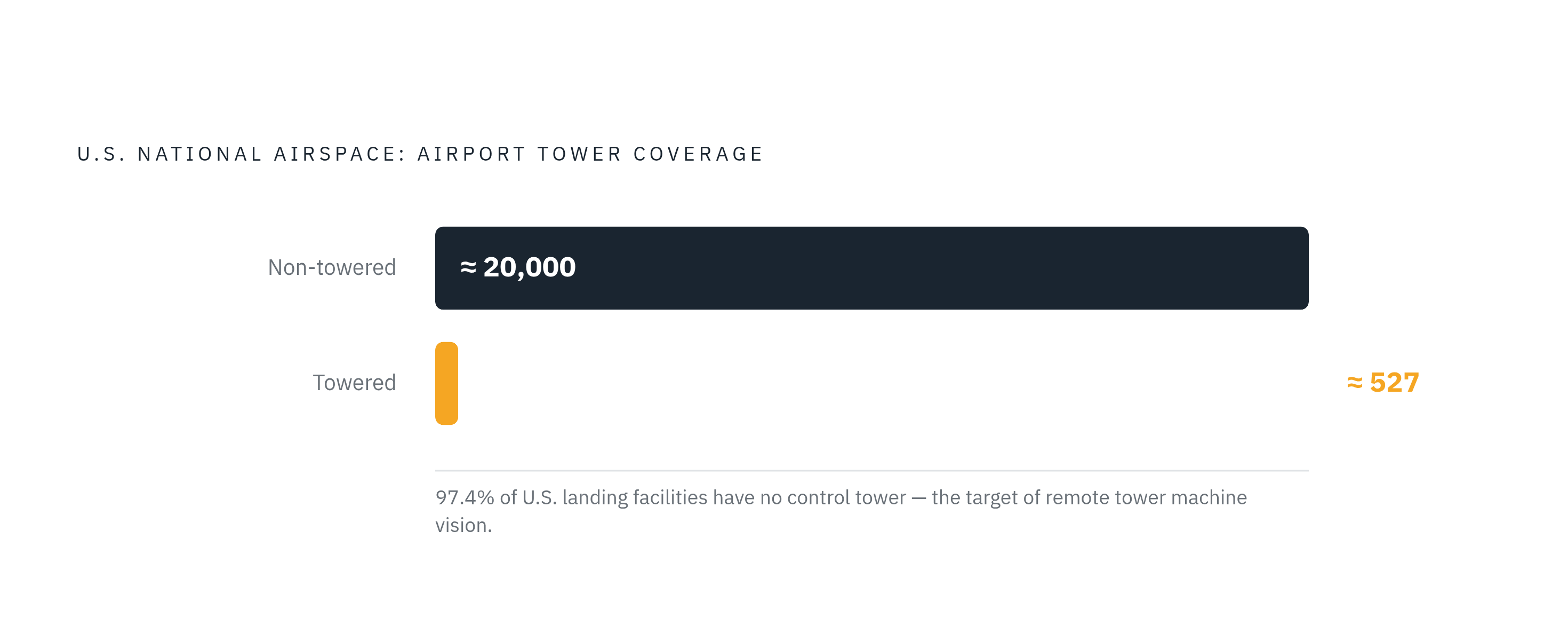
The airports that need remote tower coverage most are the ones where no detection capability exists today, human or machine, so pilots have to manage their own separation with no controller watching. That turns the detection accuracy threshold into a life-safety question rather than an engineering benchmark to be optimized for its own sake. The scale of the gap is large: the United States has roughly 527 towered airports against nearly 20,000 non-towered landing facilities, and the overwhelming majority of airports in the National Airspace System operate with no one watching from a tower at all. Most midair collisions happen in clear weather, near an airport, at low altitude, and that is precisely the visual environment a camera array and its AI tracking layer are built to cover. Closing that gap is the actual argument for machine vision in remote towers: not a convenience added to an existing service, but the detection capability that tens of thousands of airports currently do without.
Sources
- Research on object detection and recognition in remote sensing images based on YOLOv11 | Scientific Reports
- Vision Systems: Expert Guide to Industrial Machine Vision
- Deep Learning in Automated Power Line Inspection: A Review
- Vision-Based Power Line Cables and Pylons Detection for Low Flying Aircraft
- Remote working: the benefits of remote ATC - Airport Technology
- Digital Towers: A new standard for air traffic management - KONGSBERG - an international technology group