Sensor Stack Trade-Offs in Low-Cost Digital Tower Architectures for Uncontrolled Airports
Sensor choices determine which blind spots a low-cost digital tower actually closes.

Affordable digital towers for non-towered GA airports start with cooperative surveillance, supplemented by fixed cameras and infrared coverage. This architecture can improve traffic awareness without a conventional tower building, but it is not equivalent to approved ATC service. Sensor choices determine which safety gaps close and which remain, particularly for non-transmitting traffic in poor visibility.
Why uncontrolled airports face a structurally different risk than their traffic volume suggests
Runway risk at uncontrolled airports is poorly represented by aggregate incursion counts because the reporting framework assumes infrastructure these fields do not have. The FAA’s taxonomy includes pilot deviations, vehicle/pedestrian deviations, and operational incidents. Operational incidents require a controller, so that category disappears at an airport without a tower. The reporting framework therefore loses one whole category. Comparing totals without allowing for that missing category can hide the risks of operating without a controller.
Until early 2026, every recent fatal runway incursion accident in the U.S. had occurred at a non-Part 139 airport without a control tower. The March 22, 2026 fatal collision at LaGuardia Airport, a towered, Part 139 facility, broke that pattern. Severe Category A and B incursions also rose sharply in fiscal year 2025 while total incursion counts barely moved.
DOT OIG’s March 2025 audit found that the FAA lacks an integrated approach to analyzing runway incursion data and identifying risk. That finding limits what system-wide totals can establish about local exposure. A measurement framework built around towered operations cannot accurately characterize, let alone address, uncontrolled-field risk without accounting for the missing oversight and incomplete data.
How a digital tower closes the coverage gap — and where sensor choices determine how much of it actually closes
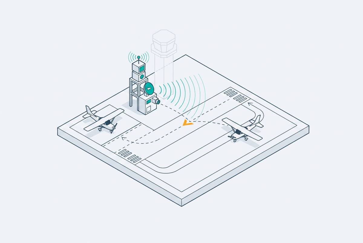
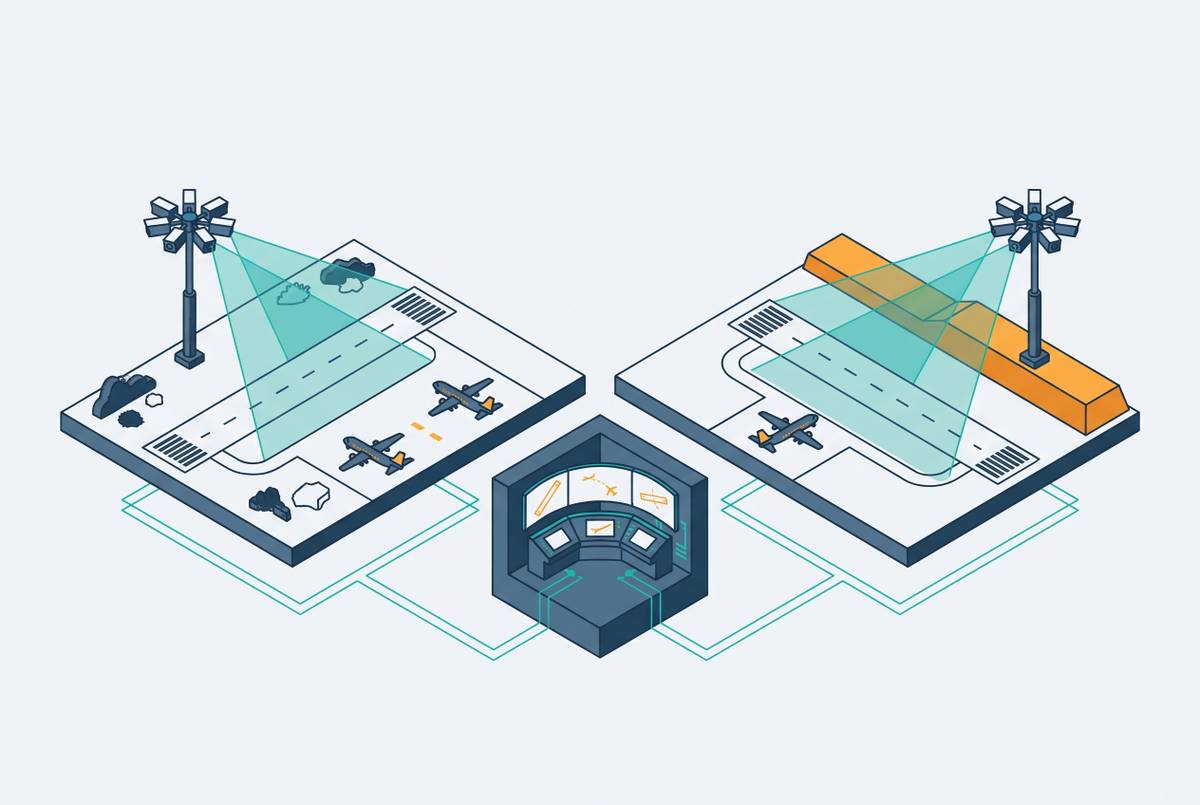
A digital tower replaces a controller’s out-the-window view with an operational picture assembled from sensors. Instead of a conventional tower building, sensors attach to a small structure or pole approximately 33 to 164 feet high, aimed at arrival and departure paths, ramps, and the airfield perimeter. The panoramic display must let controllers keep track of the whole movement area at all times. Coverage gaps become gaps in controller awareness. Augmented reality overlays and aircraft identifiers help interpret the picture, but cannot compensate for targets the underlying sensors never detect.
The fundamental division is between cooperative and non-cooperative surveillance. ADS-B and Remote ID track aircraft that broadcast a signal, while optical cameras, radar, and acoustic sensors can detect traffic that does not. Neither layer is a substitute for the other. Many older GA aircraft lack ADS-B Out, ultralights and gliders may have no electronic signature, and ground vehicles almost never transmit. Combining the two layers is therefore necessary for full coverage, but the sensors selected and their integration set the system’s practical limits.
The cooperative surveillance layer — what ADS-B offers and what it leaves undetected
ADS-B is the most cost-effective foundation for digital tower surveillance because its lower unit cost and higher effective range reduce the number of sensors needed to cover an area. ADS-B and Remote ID sensors have a positive net present value when assessed over ten years. This cost advantage is large for small airports. The same cost logic underlies the FAA’s move toward broadcast-based situational awareness at towers that operate without radar. Managed-service position reporting and tracking also provide an entry route for airports supported by fuel sales, hangar and tie-down rents, and leased shop space.
That value depends on traffic being electronically cooperative. An aircraft without suitable equipment, or with equipment switched off or malfunctioning, is invisible to a system relying solely on position broadcasts. Drones and ground vehicles without ADS-B transmissions are also absent. This is an equipment boundary. At uncontrolled airports with varied traffic, it leaves actors outside the surveillance picture precisely because they do not meet the system’s broadcast assumption.
Multilateration, or MLAT, widens that cooperative coverage by triangulating transponder signals from multiple receivers without requiring a satellite-navigation-derived position broadcast. It can therefore extend surveillance beyond traffic equipped to broadcast its position. It still requires an aircraft to transmit something. The relevant distinction is not simply ADS-B versus MLAT, but transmitting versus non-transmitting traffic, which makes a non-cooperative layer a necessary complement.
The non-cooperative surveillance layer — cameras, radar, and acoustic sensors compared on cost and capability
Optical cameras provide the panoramic view at the core of a digital tower, with high-definition, infrared, and night-vision capabilities supporting different viewing conditions. To keep 360-degree coverage, the airport needs several cameras with views that overlap across its operating areas. Fixed cameras are cheaper per unit and simpler to maintain than pan-tilt-zoom cameras. Their principal advantage is continuity. A PTZ camera can follow a landing aircraft closely, but it is not simultaneously watching a crossing taxiway.
The coverage trade-off between fixed and PTZ cameras remains even with on-screen overlays. An aircraft identifier attached to a camera image depends on accurate surveillance data, and an overlay without position data for non-cooperative aircraft shows only targets already known.
Radar addresses a different weakness by detecting non-cooperative aircraft in fog, rain, and night conditions where camera performance degrades, even with infrared augmentation. Its high initial cost is the central obstacle. Without radar, coverage in low visibility relies on cooperative surveillance or cameras with infrared, which have known limits. Acoustic sensors offer lower upfront cost than radar and can detect engine signatures without a transponder, but have shorter effective range and sensitivity to wind and ambient noise. Passive RF sensors and Remote ID receivers complement broad non-cooperative coverage in narrower roles, particularly around drone detection.
Why sensor fusion is necessary but structurally difficult on a constrained budget
Fusion requires correlating ADS-B positions, camera tracks, and acoustic detections in one operational picture. Otherwise, one aircraft can appear as disconnected contacts. An uncorrelated cooperative track and camera return can produce duplicated symbology, while dropping an observation can result in a missed contact. Flight Safety Foundation’s 2025 Safety Report identifies surveillance and communications interoperability as areas requiring accelerated modernization, a system-level concern that applies directly to this integration problem.
When ADS-B is fused with cameras but no radar, non-cooperative traffic can still go undetected in low visibility. Radar without PTZ removes the ability to zoom in for visual confirmation of ambiguous contacts. Neither combination eliminates the need for controller judgment. Budget-constrained airports must therefore evaluate detection, continuity, and confirmation together rather than treating each sensor as an independent procurement option.
The financial difficulty is that small airports rarely have the capital to cover both cooperative and non-cooperative detection comprehensively. Remote Tower Centre architectures let several airports with little traffic share the cost of infrastructure that can do more. Shared operations change the basis of the investment. Instead of requiring every airport to sustain a standalone facility, centralization supports a common operating environment, making more complete fusion financially plausible per site.
How deployed remote tower programs have navigated sensor trade-offs in practice
Norway’s Bodø Remote Tower Centre, part of the Kongsberg / Avinor NINOX Programme, managed 14 airports from a single centre as of April 2025. Seven additional airports were scheduled to go live within two to three years, and the system allows up to three airports to be managed from one controller position. Avinor’s motivations include avoiding new or renovated tower construction, reducing operating costs, standardizing service, and easing recruitment. Sensor investment is assessed within shared infrastructure rather than against each airport’s standalone revenue.
ENAV’s April 2025 expansion plan applies the same logic to low-traffic airports in Italy. It calls for converting the Brindisi and Padua control centers into remote tower hubs managing 16 airports, with a total of 26 remote towers targeted by 2033. Pooling is the common feature of both programs. These deployments support the case for centralized architecture, but their scale alone does not establish that every sensor compromise is acceptable under every operating condition.
Local users embraced the remote tower operation at Leesburg Executive Airport, although operational acceptance does not by itself validate a particular sensor configuration. Johnston Regional Airport and Raleigh Executive Jetport both received FAA approval for traditional towers estimated in the tens of millions of dollars each. Johnston’s director puts the cost of a digital remote tower at roughly half that. These facility-level comparisons illustrate why comprehensive surveillance remains expensive even when avoiding a conventional tower.
The policy environment that shapes which sensor architectures are viable in the U.S. right now
The FAA Reauthorization Act of 2024 required a defined remote tower approval process, published testing milestones, and expanded system design evaluation at no fewer than three airports outside the Atlantic City Technical Center. Those requirements make validation part of architecture selection. The FAA’s request for proposals, with potential procurement of up to 50 remote ATC tower systems over five years, also creates a reason to standardize sensor configurations across deployments. Standardization could support repeated deployment, but each configuration remains subject to approval requirements.
The FAA has recently granted conditional system design approval for digital towers, establishing a foundation for further deployment. That approval is limited to system design, with operational approval and coverage of multi-airport operations still required before the shared-controller model demonstrated abroad can be assumed available for a U.S. project. The distinction is financially consequential because centralized operations are a principal route to distributing the cost of more capable surveillance.
The FAA’s Office of NextGen terminated on December 31, 2025, while a new office continues NAS2040 modernization using its infrastructure and foundational architecture. That federally built cooperative-surveillance foundation reduces the burden of establishing an ADS-B layer at individual airports. The FAA’s Surface Awareness Initiative has reached only a limited number of airports, while hundreds of towered airports still lack modern surface awareness technology.
Capital and staffing pressures strengthen the incentive for alternatives. The FAA estimates a $5.3 billion backlog of facility components past their service lives, and its Federal Contract Tower program was significantly below targeted headcount as of April 2025. Shared remote operations help reduce the number of staff each airport needs. Even with these cost and staffing pressures, a proposed architecture must meet approval requirements before it can enter service.
How can a non-towered airport add affordable traffic awareness, and what can it not yet do?
A realistic entry-level design uses ADS-B/MLAT cooperative surveillance as a managed-service foundation, supplemented by fixed HD cameras with infrared augmentation. Remote ID receivers fit where drone integration is a near-term operational concern. This is a bounded capability. It supports equipped GA traffic, IFR operations, and surface awareness across the primary movement area in daylight and moderate visibility, while providing a basis for UAS coordination as the regulatory framework matures.
The residual weaknesses must remain explicit in the operating concept. Non-equipped or malfunctioning aircraft may be visually detectable, but lack dependable coverage when visibility defeats the cameras. Ground vehicles present the same low-visibility problem. PTZ can give a closer look to confirm a contact, but fixed coverage is still needed to watch different locations at the same time. Adding radar addresses non-cooperative low-visibility detection, although its cost tends to produce a negative net present value over the standard analysis horizon for most small airports.
Airports should design for the mix of traffic they have and how much of it is equipped, record detection gaps in their operational procedures, and add sensors as demand shows they are needed. An airport needs a sound financial case to add radar. Shared infrastructure or grant funding can support that case, but funding for this purpose does not currently exist at scale. The standard for an affordable proposal is not how closely its display resembles a tower window, but which previously unseen risks it detects, under what conditions, and which it explicitly leaves unresolved.