Situational Awareness Data Feeds That Surface UAS Presence at Non-Towered Fields
A tiered detection plan can finally warn pilots about drones.
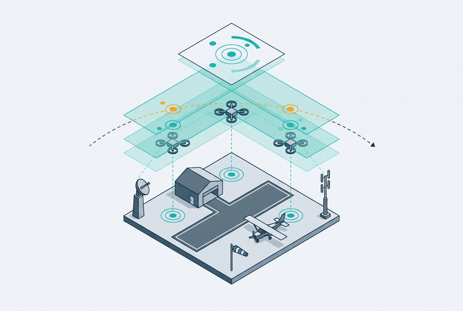
Non-towered airports need layered UAS detection feeds that link ground sensors to air traffic systems and give pilots warnings they can act on. Digital ATC infrastructure can complete that chain by combining sensing, processing, and a controller’s communication link. The practical path is risk-tiered deployment, starting with Remote ID and RF detection, with the data pathway designed from the outset.
Why non-towered airports are uniquely exposed to drone conflicts
Drone activity can be legally permitted near a non-towered airport while no authority watches that activity or communicates it to arriving pilots. Permission and oversight do not arrive together. Pilots at these fields rely on self-separation, without a controller to synthesize the traffic picture or issue alerts. That structural mismatch puts manned and unmanned aircraft near the same runways without a shared account of who is there.
Embry-Riddle Aeronautical University’s systematic review found that conventional ATC radar and ADS-B, optimized for large, fast, cooperative targets, routinely fail to detect low-slow-small UAS without a transponder. Both compliant and non-compliant operations can therefore remain outside the traffic picture available to an arriving pilot.
The remaining fallback is often a visual sighting. The Embry-Riddle review identifies reactive detection, including pilot sightings, as a source of dangerously short response times when an untracked object appears on a flight path. A ground observer offers no dependable substitute for continuous surveillance. The exposure is therefore not simply that drones may be present, but that their presence may become known only when a pilot must respond immediately. A purpose-built feed gives pilots the warning time that existing airport systems cannot be assumed to provide.
What the absence of detection actually costs in the traffic pattern
Without a detection feed, three failures cascade through airport operations. The pilot lacks awareness of the drone, the airport operator lacks a data baseline, and any response depends on external authorities that cannot always arrive in time. Each failure constrains the next opportunity to intervene. Inadequate detection combines with absent legal authority and fragmented procedures, leaving the airport dependent on a response structure outside its immediate control.
Gillespie Field provides a brief contrast. On March 1, 2025, tower personnel at that airport in El Cajon, California, confirmed a UAV at approximately 1,000 feet when a Cessna 172 pilot took evasive action. The tower provided an observation and communication fallback that a non-towered field lacks.
Pilot vigilance and advisory radio communications remain important, but they cannot supply information nobody has acquired. Near-collisions occur significantly more often when a pilot has received no prior radio warning of other traffic, while a drone operator is under no obligation to broadcast on CTAF. Radio use alone cannot resolve that asymmetry. Without a ground-based source of UAS information, pilots may be listening attentively to a frequency that contains no warning of the hazard.
Why each individual sensor modality leaves gaps a non-towered airport cannot afford
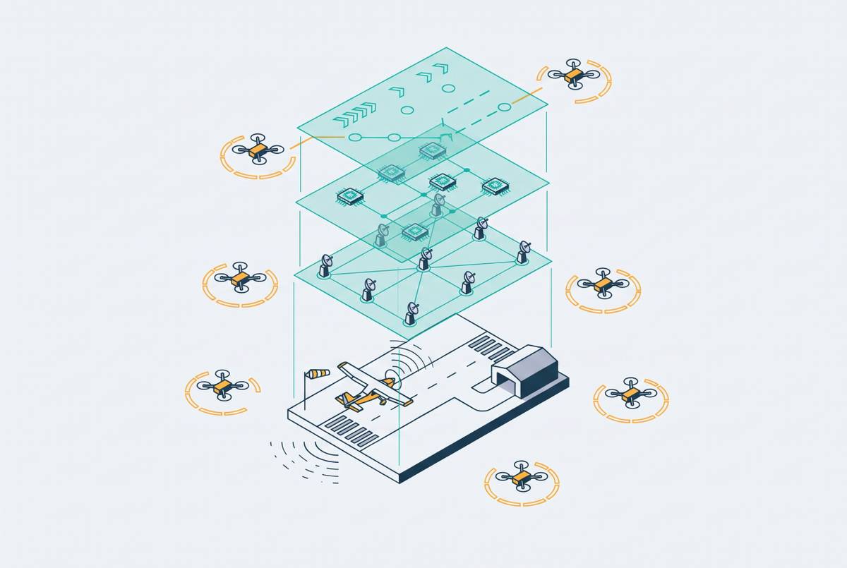
The Embry-Riddle review of thirty-six studies found that no single sensor modality adequately detects low, slow, and small targets. Each leaves a different coverage gap. At a low-resource airport, making one modality the entire detection architecture turns its limitation into a single point of failure. The relevant comparison is therefore not which sensor is universally best, but which gaps remain after it is installed.
Radar offers effective range and all-weather operation, but systems optimized for large, fast targets struggle with the characteristics of small drones. Drones and birds can also share radar signatures and motion patterns, producing false alarms and reducing confidence. RF detection has a different boundary. ACI’s counter-UAS strategy guide describes passive sensors that scan for the signals a drone and its controller send to each other. These sensors are cost-effective, non-intrusive, and scalable, but they cannot detect autonomous or non-transmitting UAS through signals those aircraft do not emit.
Acoustic sensors have a short range where there is noise, while electro-optical and infrared sensors depend on line of sight and lighting conditions. Robin Radar’s airport guidance identifies the operational ideal as wide-area detection that distinguishes drones from birds and tracks multiple moving objects simultaneously. Layering is consequently a response to distinct failure modes, and its scope must reflect the airport’s actual exposure and resources.
A risk-tiered deployment framework that matches sensor architecture to airport scale
The Embry-Riddle review recommends matching the system to the risk, from Remote ID reception in low-risk rural areas to full multi-sensor fusion at high-density hubs, major airports, and advanced air mobility vertiports. This creates a practical entry ramp. An airport need not defer all detection until it can afford the most extensive architecture. It can begin at the tier its risk profile and budget support, while recognizing the limits of that starting point.
The first tier uses Remote ID to receive local broadcasts. All pilots operating registered drones had to comply from March 16, 2024, and broadcast data helps tell compliant airspace users apart from those that may pose a safety or security risk. Its limit is fundamental, however. Non-cooperative UAS without a broadcast remain invisible to a receiver-only system.
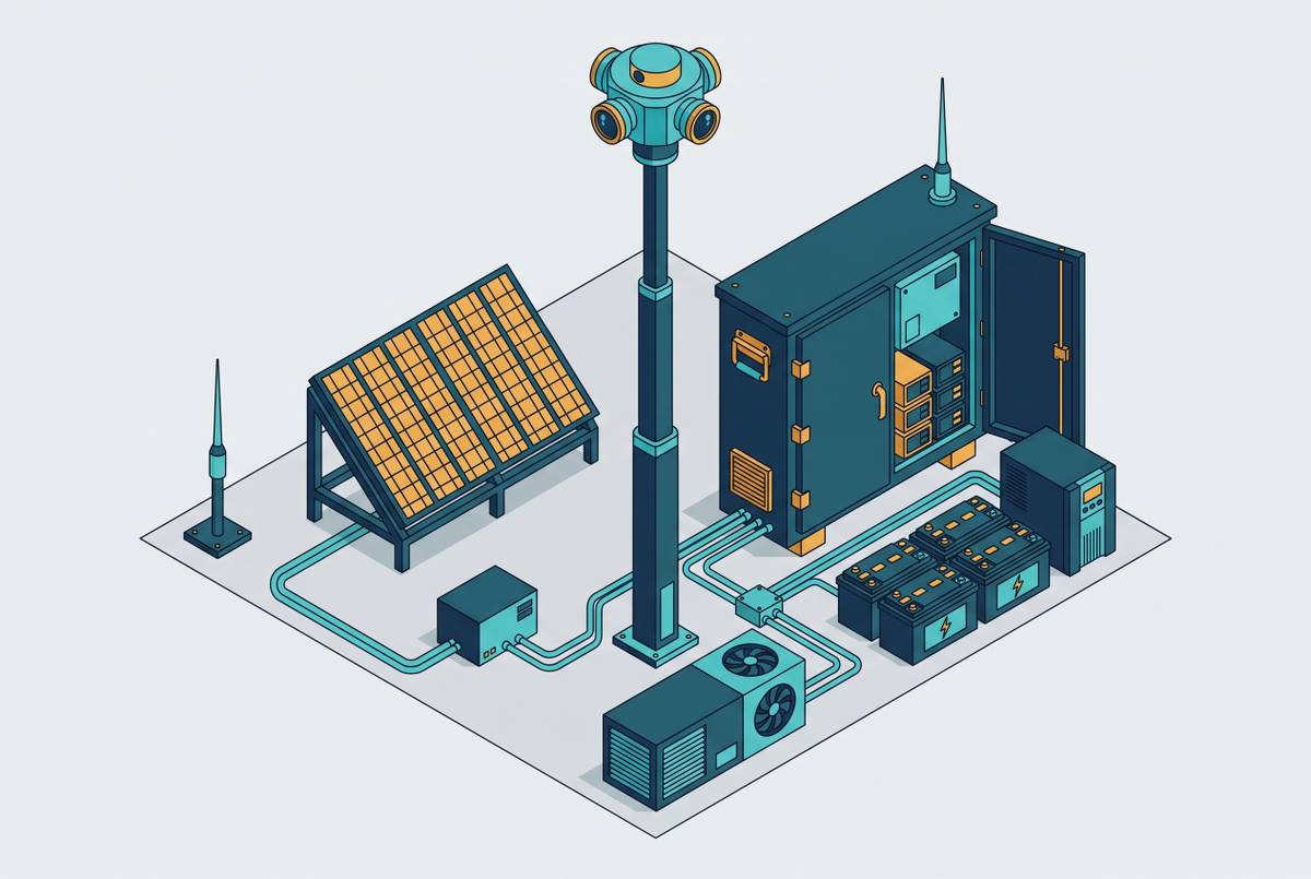
ACI’s guide recommends starting with RF hardware because its passive, non-intrusive sensors need no further regulatory permission. Smaller airports may need only one strategically placed sensor. From there, an airport can build an RF sensor network, add EO/IR and acoustic sensing, and move to full multi-sensor fusion with Air Traffic Management and UAS Traffic Management integration.
Authorization data adds context to these detections. The same guide recommends connecting the geozone to a UTM system to create a verifiable record of every authorized drone operation and help identify operations without approval. The Embry-Riddle review proposes standardized data-exchange interfaces with ATM and UTM. Those interfaces are the bridge between a sensor event and information that a controller or pilot can use.
How the data feed chain must work to actually reach the pilot in the pattern
A sensor can register a drone without giving the pilot in the pattern any useful awareness of it. The Embry-Riddle framework applies Endsley’s Situational Awareness model, which requires perception, comprehension, and projection. The feed must support understanding of the detected presence and its operational significance.
Remote ID illustrates the distinction between transmission and delivery. Its broadcasts are local, and the FAA does not collect Remote ID data in a central database. Receiving a broadcast does not by itself send the information to an authority or pilot. The complete chain from ground-based sensor to controller workstation to CTAF call or digital cockpit display does not yet exist as a certified, deployed system at any non-towered U.S. field.
The FAA’s proposed Part 108 rule, issued on August 7, 2025, points policy toward using Remote ID for separation awareness during BVLOS operations. It proposes optimizing broadcast range so other aircraft can use the signal for situational awareness and identify BVLOS UAS to remain separated by a safe distance. The proposed rule does not itself provide the processing, interfaces, or human communication needed at an airport.
A CTAF alert also depends on someone producing it. Without a persistent ground-based feed that continuously synthesizes the picture, awareness relies on a person monitoring detection output and making manual calls. That is unreliable at an uncontrolled field without full-time staff. The integration requirement follows directly from this limitation. Sensors, standardized ATM/UTM interfaces, and the pathway to the pilot must be planned together.
How digital ATC infrastructure can host UAS awareness at non-towered airports
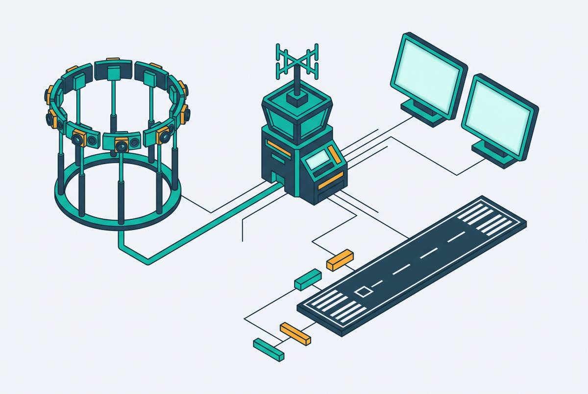
A digital tower provides a natural integration point because it brings together a sensor array, processing infrastructure, and a human communication link. The controller supplies the missing operational handoff. With an integrated UAS feed, that controller can synthesize detection data, advise traffic on CTAF, and combine isolated sensor events into a continuous picture.
Leesburg Executive Airport in Virginia demonstrates the underlying architecture. Its digital tower used large-format wall screens to provide a 360-degree view of the airfield, supported by cameras and sensors covering the airport. That arrangement shows how ground-based sensing can reach a controller workstation without a conventional tower structure. The system shut down in June 2023 and never received FAA certification, so it is an architectural example rather than proof of a certified UAS integration service.
The FAA issued an RFP in April 2026 for remote air traffic control tower systems to serve rural, small community, and non-towered airports. That procurement direction creates a natural place to integrate UAS feeds into digital ATC infrastructure. Linking these systems still needs standards and a working path for the data. UAS participation in the NAS needs a fixed, instrumented point capable of tracking manned and unmanned traffic and communicating the picture to airspace users. A digital tower can host that work and make drone awareness part of the same task. General Aviation, a US-based provider of remote tower systems that connect small airfields to certified controllers, builds this kind of platform for fields where drone activity is growing but oversight is absent.
What airport operators and policymakers need to do now to close the gap
For airport operators, the first step is a risk assessment that establishes the baseline threat profile. Robin Radar’s guidance recommends that every staff member able to observe a drone understand the threat and have a clear reporting channel. Staff reporting establishes a starting point for response. A Remote ID receiver and a single RF sensor can then form a first-phase detection layer within a constrained budget, creating the data baseline from which the airport can build.
Geozone definition, UTM linkage, and standardized interfaces with ATM belong in the architecture from day one. Technology deployers should plan these connections with the sensing layer. Otherwise, the airport risks acquiring detection capability without the pathway needed to turn it into a warning for traffic.
For policymakers, certification is the next critical dependency. The FAA RFP and BNATCS funding signal federal intent, but scalable deployment requires clear certification standards and standardized interfaces connecting detection feeds to digital tower systems. The FAA Reauthorization Act of 2024 included Section 621 provisions aimed at addressing the impasse over remote and digital towers. The lack of formal standards and the FAA’s ad hoc approach had deterred airport sponsors and technology vendors.
Funding must also fit staged deployment. Non-towered airports face chronic underfunding, and AIP Non-Primary Entitlement grants cannot absorb a full detection stack in a single year. Policymakers need grant pathways that treat UAS detection as eligible safety infrastructure. The complete system is technically achievable, comprising a digital tower hosting an integrated UAS detection feed, a UTM connection, and a controller able to advise traffic on CTAF. Certification standards and procurement are the remaining steps needed to make that architecture operational.