Mixed-Airspace Data Architecture for Rural Airports Integrating Manned and UAS Operations
Voluntary radio calls can't coordinate drones, so rural fields need shared data.

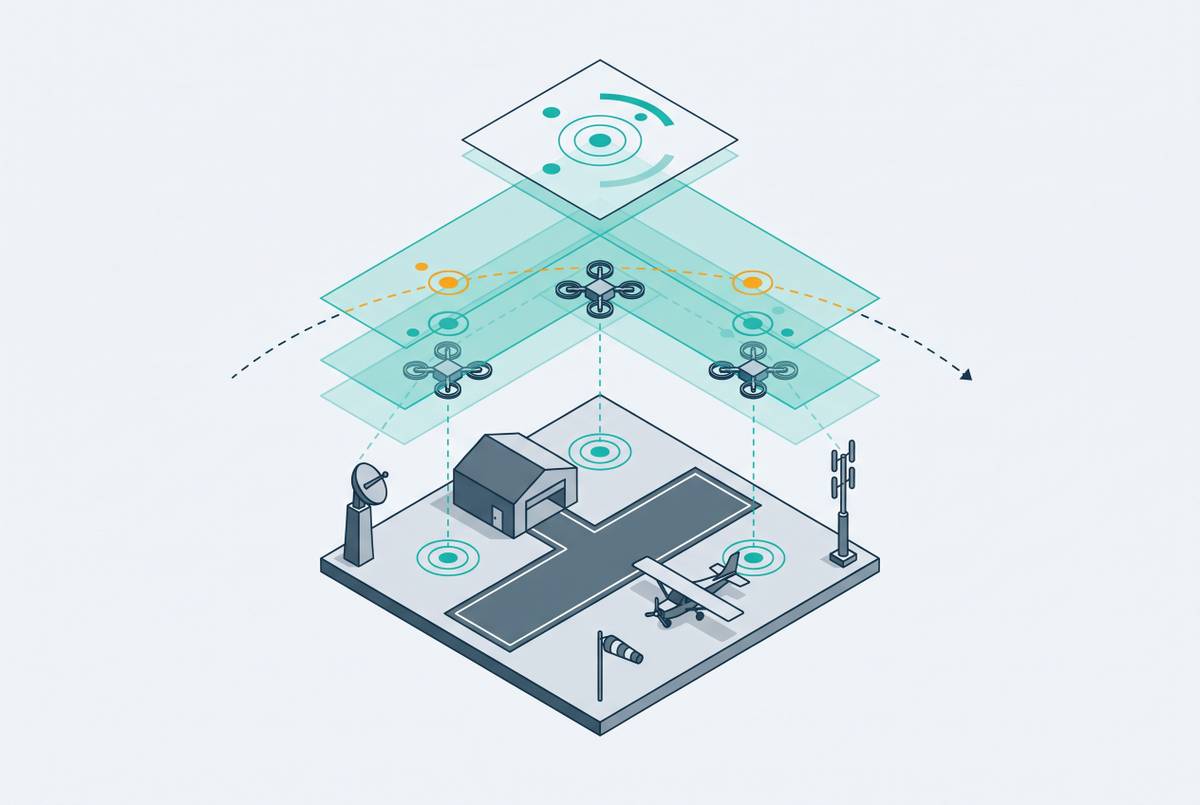
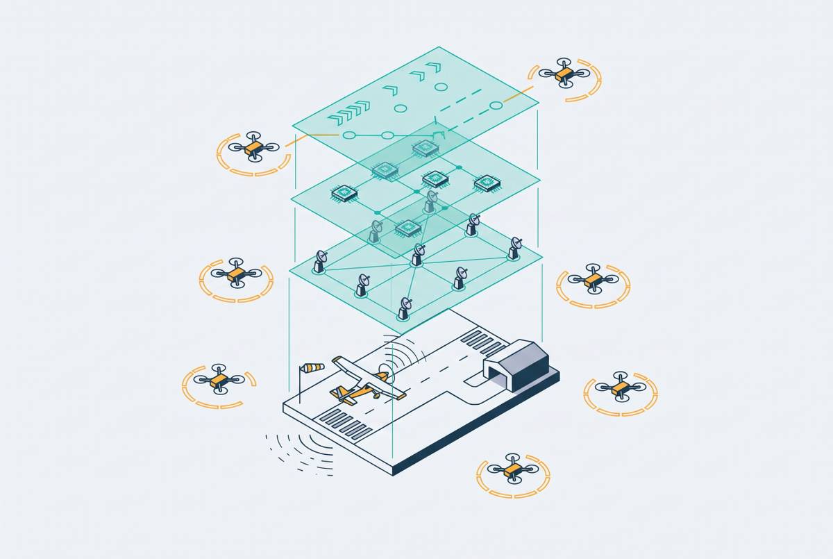
Rural, non-towered airports need a data architecture built to bring manned aircraft and unmanned aircraft systems (UAS) together, because voluntary radio calls cannot coordinate mixed traffic on a large scale. Digital ATC infrastructure provides the platform for combining aircraft surveillance, drone telemetry, and flight intent into one operational picture. That architecture must do more than display traffic. It must ingest, correlate, present, and act on information through channels both manned and UAS pilots can use.
Why self-announce procedures were never designed for unmanned traffic
At a non-towered airport, pilots announce their positions and intentions on a shared Common Traffic Advisory Frequency (CTAF), listen for other aircraft, and scan visually. Each pilot assembles a traffic picture from what is heard and seen. Radio calls are voluntary, so that picture can be incomplete even when everyone follows the law. Traffic-pattern rules, including left turns under 14 CFR § 91.126, are legally required, but no external authority verifies compliance in real time.
The distinction between required flight behavior and voluntary communication is central to how these airports operate. The system depends on pilots observing one another and interpreting spoken intent, rather than on an independently maintained traffic picture. Local familiarity helps pilots interpret those signals. Yet non-towered fields draw a disproportionate share of transient pilots unfamiliar with local patterns, precisely where no controller is available to compensate for that unfamiliarity.
UAS do not reliably fit this procedural design. Remote pilots may receive incomplete, delayed, or no radio traffic information, while an unmanned aircraft cannot make a voice position call in the way a manned aircraft can. Regional UAS operations are expected to use non-towered airports frequently, despite limited separation principles and only partially observable manned traffic intent. The mismatch is therefore procedural before it is technological.
What the safety record at non-towered airports already looks like before UAS scale
The safety record so far gives little reason to trust self-announcement as the basis for handling more mixed traffic. Severe runway incursions, Category A and B, rose by nearly half in fiscal year 2025, even as the total number of incursions fell slightly. That divergence distinguishes frequency from severity. A lower aggregate count does not establish that the conditions producing near-collisions have improved.
The location of fatal events sharpens the concern. Every fatal runway incursion accident in recent years occurred at a non-Part 139 airport without a control tower. These were a small number of events, but their concentration identifies a low-frequency, high-consequence risk at uncontrolled facilities. Near-collision reports filed by pilots also show that roughly three-quarters take place within ten nautical miles of a non-controlled aerodrome. Near-collisions occur at twice the rate when a pilot had no prior radio warning of other traffic.
Classification requires care when interpreting this record. Pilot deviations account for close to two-thirds of all U.S. runway incursions, but the operational-incident category requires a controller and therefore cannot apply at a non-towered airport. The categories do not provide equivalent views of towered and non-towered operations. At uncontrolled fields, pilot deviation becomes the default category rather than a complete explanation of the underlying procedural weakness.
Separate trends add pressure to that baseline. IATA’s 2025 Annual Safety Report shows a sharp rise in GNSS interference, which threatens the navigation and surveillance information that mixed-airspace systems rely on. EASA’s Annual Safety Review 2026 counted 39 drone accidents and serious incidents in 2025, substantially more than in the prior year. The review ranked airborne collision as the top UAS risk area for 2023–2025.
Why adding UAS to this environment compounds every existing vulnerability
Adding UAS changes both what pilots must spot and understand and how many aircraft they must make room for. A manned pilot listening to CTAF receives no reliable indication of a drone that cannot participate in verbal coordination. Visual scanning does not reliably close that gap. A UAS without a transponder, or operating under Remote ID alone, does not provide the existing coordination system with a dependable traffic signal.
The information gap also runs in the opposite direction. A remote pilot with incomplete radio information has an unreliable picture of nearby manned traffic’s intentions, compounding the existing dependence on voluntary announcements, especially when transient pilots are unfamiliar with local patterns. Rural airports often have no radar coverage and little communications infrastructure, so both pilots have fewer independent sources to help fill in the missing picture.
Navigation interference introduces a second, connected vulnerability. UAS rely on satellite navigation for positioning, altitude hold, and return-to-home functions, so GNSS degradation puts both flight functions and the reported position used for coordination at risk. As of early 2026, the FAA employs far fewer fully certified controllers than its staffing targets require, and inspector general data identified hundreds of “ATC zero” events between February and May 2025.
What a purpose-built data architecture for mixed-airspace operations must actually do
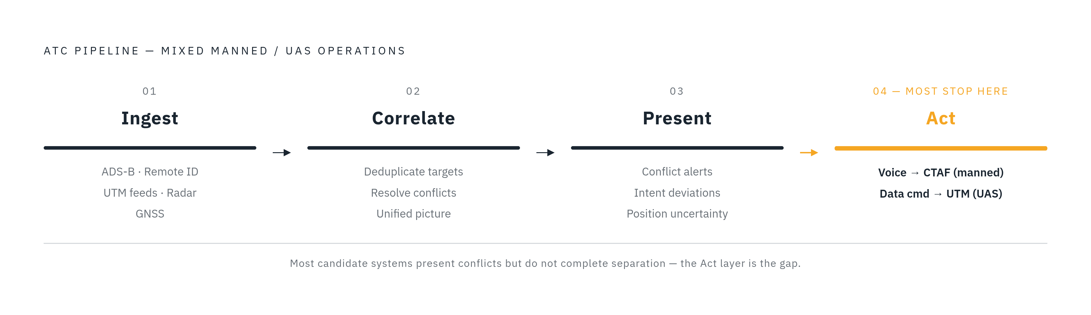
The ingest layer must accept fundamentally different traffic sources simultaneously, including ADS-B, Remote ID broadcasts, UTM platform feeds, radar where available, and GNSS position data. No source is complete on its own. ADS-B misses UAS without transponders, while Remote ID has a short range and was not built for real-time ATC integration. UTM platforms contain drone intent information that ATC systems do not natively consume. Ingest must therefore preserve position uncertainty and flag data-quality problems rather than treating satellite-derived coordinates as ground truth.
The correlation layer must turn those feeds into one traffic picture, deduplicating targets, resolving conflicting position reports, and identifying unknown intent or tracks inconsistent with filed plans. Separate overlays leave the integration work to a person. The required function is a shared view in which UTM information appears with radar and ADS-B targets. At the New York UAS Test Site, trials overseen by a defense innovation organization demonstrated drones using mesh radios and satellite links to share telemetry with the CLUE UTM system. Combining that telemetry with ADS-B and radar feeds produced a visual situational-awareness tool for air traffic deconfliction.
The presentation layer must make the correlated picture easy to use when time is short. An operator or remote controller needs conflict alerts, intent deviations, and position uncertainty to be visible. A display is more than a map. Digital tower sensor suites contribute high-definition cameras, automatic target detection, aircraft data tags, infrared imaging, and enhanced low-light visibility. Their data-stream output can show mixed traffic in a form that helps operators decide what to do.
The action layer must pass those decisions on to pilots. For manned traffic, a remote operator may issue a voice advisory over CTAF, while a UAS remote pilot may receive a data command through the UTM link. Both channels must be supported at the same time. Separation advisories, conflict alerts, or automated holds must reach the party able to respond. Existing CTAF procedures do not supply this four-layer digital architecture.
Why digital ATC towers are the natural platform for this architecture at rural airports
A digital ATC tower replaces dependence on direct line-of-sight observation with a sensor and data platform. Its camera and detection outputs can be augmented with ADS-B, Remote ID, radar, and UTM feeds. Manned and unmanned aircraft can appear on one display for a remote operator rather than remain divided between visual observation and a separate drone-management system.
Remote operation also changes the economics of coverage. A single facility can manage multiple airports simultaneously, with one controller certified for several aerodromes. This model connects the technical architecture to the staffing constraint where traffic is too low to make a dedicated on-site controller economically viable, allowing the sensor and data infrastructure to remain at each airport while operational oversight is provided remotely.
Avinor’s Remote Tower Centre in Bodø, Norway demonstrates the multi-airport model. A July 2024 agreement with Kongsberg Defence & Aerospace is set to expand the centre’s airport portfolio by 2027. Italy’s ANSP ENAV announced in April 2025 that it will convert its Brindisi and Padua control centers into remote tower centers, initially managing 16 low-traffic airports, with a target of 26 by 2033. These examples establish the remote operating model. To handle mixed airspace, this model also needs to bring UAS surveillance, intent, and action channels together.
The policy and funding environment that makes this architecture both urgent and achievable now
The FAA Reauthorization Act of 2024 directed the FAA to establish a formal remote tower approval program and extend the approval process to at least three airport locations. It also requires congressional briefings through October 1, 2028. That creates a defined regulatory pathway for deployment. The Working Families Tax Cut Act separately set aside money to advance digital towers at qualified non-towered airports under the FAA Brand New Air Traffic Control System (BNATCS) initiative.
A June 2025 executive order required the FAA to publish a civilian UAS integration roadmap for the NAS by February 2026. In August 2025, the FAA proposed rules requiring drones flying beyond visual line of sight to detect and avoid other aircraft. Even so, these proposals support infrastructure that can show nearby traffic and help operators act on conflicts.
Congress also required an integrated plan for the future state of the NAS by May 2027. Digital tower and UTM integration therefore belong in near-term infrastructure planning. The funding window is more constrained. The Bipartisan Infrastructure Law’s supplemental aviation funding covers FY2022–FY2026 and is scheduled to expire at the end of FY2026, after which federal airport grant funding returns to a substantially lower baseline. Rural airports acting before that contraction are better positioned to fund the underlying infrastructure.
Industry organization is reinforcing this policy direction. The Digital Tower Technology Coalition launched on April 22, 2026 in Washington, D.C., citing the reauthorization act as its driving mandate, and joined the Modern Skies Coalition. That alignment supports broader NAS modernization, but it does not remove the staffing constraint. The gap between certified controller employment and FAA targets runs to thousands of professionals.
What rural airport operators should demand from a mixed-airspace data architecture
For operators evaluating an investment, the four functional layers should become acceptance criteria rather than a feature checklist borrowed from commercial hub airports. Multi-source ingest must take in ADS-B, Remote ID, UTM feeds, and radar at the same time without relying on any one source. GNSS-degraded conditions must produce visible uncertainty. Correlation must then yield one traffic picture. A system that makes an operator mentally reconcile separate manned and unmanned displays has not performed that function.
Evaluation should also follow the information through to action. A conflict displayed without a means to reach either pilot improves awareness but does not complete the separation process. Candidate systems must support voice advisories to manned pilots and data-link communication to UAS remote pilots. Both paths belong in the operating design. Where dedicated on-site staffing is uneconomic, the architecture must also support remote coverage of more than one airport from a single facility.
Long-term support and regulatory standing complete the decision. For operators who want supply chains they can rely on, systems developed and made domestically reduce reliance on foreign supply chains for critical NAS infrastructure. The formal FAA pathway also means buyers must weigh both how far a vendor has moved through the 24–36 month design approval process and what its technology can do. Deployment readiness is more than a working display.