Minimum Viable Digital Tower Stack for Non-Towered Airports Absorbing Commercial Drone Traffic
Five connected layers can give small airports a shared view of drones.
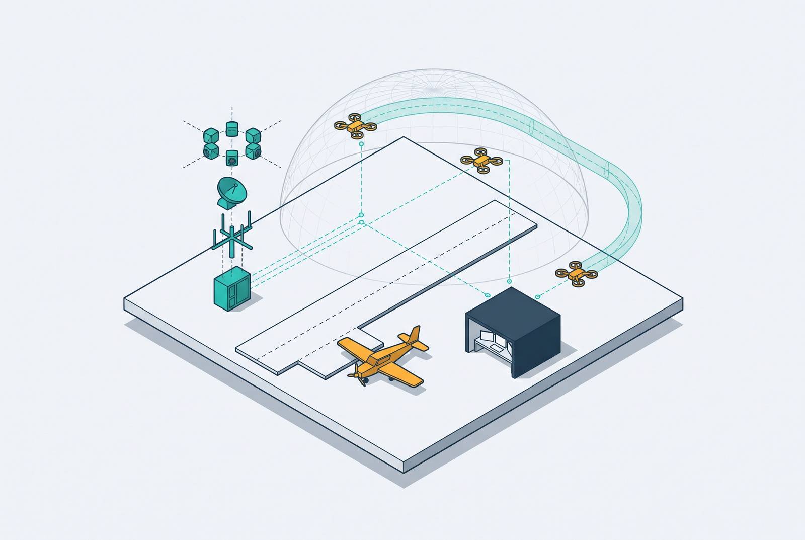
Digital ATC infrastructure can help non-towered airports see and coordinate commercial drone traffic without having to build a conventional tower. The minimum viable digital tower stack combines panoramic sensing, a closed fiber network, a controller workstation, a UAS traffic management interface, and defined communication procedures. Together, these layers turn an uncontrolled field into a managed airspace node at a cost that small airports can share through a remote hub.
Why non-towered airports are becoming the pressure point for commercial drone integration
The regulatory pathway for routine commercial drone flight is advancing ahead of the infrastructure at the airports that will absorb it. The FAA’s Notice of Proposed Rulemaking, “Normalizing Unmanned Aircraft Systems Beyond Visual Line of Sight Operations,” proposes a performance-based framework under a new Part 108. The FAA Reauthorization Act of 2024 directed that rulemaking. Yet the vast majority of public-use airports in the United States operate without a control tower. Pilots self-announce on a common traffic advisory frequency, or CTAF, without an authority to sequence traffic.
That arrangement leaves a gap as delivery, inspection, and infrastructure survey operations move toward routine beyond visual line of sight, or BVLOS, flight. Low-altitude drone corridors will increasingly pass through and loiter near the uncontrolled fields used by GA aircraft. The traffic shares airspace, but not an integrated picture. Neither the airport operator nor an arriving pilot can see all those operations together in real time.
What the incident record shows about uncontrolled airspace and drone risk
The FAA logged an incident at Battle Creek Executive Airport at Kellogg Field, Michigan, in which a pilot spotted a UAS at 2,000 feet and took evasive action. Calhoun County dispatch was notified. In the encounter described, there was no controller to alert other traffic, no radar feed, and no sequencing authority. The pilot’s response was the immediate safety barrier. Notification after an encounter is not the same as shared awareness before one.
Commercial work can create the same conflict without an operator intending to disrupt aviation. In June 2026, commercial pilots reported an unauthorized drone in their landing path at Eastern Iowa Airport. Investigators found that two drone pilots working for separate contractors at the nearby QTS data center construction site had entered the aircraft landing path without authorization. Coordination failed. A legitimate task on the ground did not make the flight compatible with arriving aircraft.
DroneShield’s survey of senior security managers, operations directors, and aviation authority officials found that airports and aviation facilities faced the most serious harm from drone threats. Most of those in the aviation sector who responded saw an unauthorized UAS near an active runway as an immediate risk to flight safety. Without detection, a shared broadcast, or sequencing authority, the individual pilot must both discover the conflict and avoid it.
How do small airports manage drone traffic without a conventional control tower?
A digital tower replaces the controller’s view through windows with high-definition cameras, digital displays, and sensors. These provide a continuous panoramic view of the airfield and surrounding airspace, allowing the controller to monitor movements and identify hazards. The change is more than a different viewing position. Automatic target detection and aircraft data tags do things a traditional glass cab cannot, and infrared cameras help controllers see in low-light conditions. Those capabilities are particularly relevant when the object of concern is a small drone.
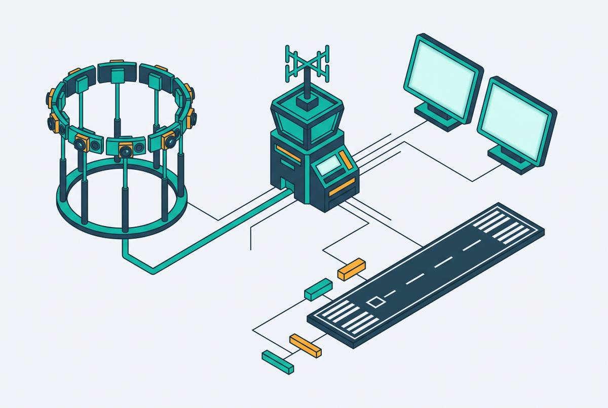
The sensor mast can stay on airport property while the operations center is elsewhere, as long as the setup meets the rules that apply. That separation makes shared control centers possible. However, current FAA guidance requires a closed, physically point-to-point network with an independent fiber-optic feed between the sensors and the control center. Wireless transmission is not currently permitted. The connection is therefore a regulatory constraint, and its physical route shapes both deployment feasibility and the architecture described below.
The five layers that compose a minimum viable digital tower stack
Layer 1 is the sensor and camera mast. High-definition cameras provide the panoramic view, infrared supports low-light and night operations, and automatic target detection flags and tags drone-sized objects. Detection is the distinguishing capability in this layer. It can surface contacts that a pilot listening to CTAF would otherwise have no means of knowing about and that a controller looking through windows might not see. Where the mast sits and the angles it covers must therefore take in commercial BVLOS corridors as well as the standard traffic pattern.
Layer 2 is the closed fiber network. The approved architecture connects the mast to the operations center through the independent, physically point-to-point feed required by the FAA. Its route and redundancy belong in site planning because they determine resilience as well as capital cost. Power protection belongs in this layer too. A UPS or backup generator should supply power to both the mast and the fiber termination point, since a fiber cut or loss of power can leave controllers without the remote view or a glass-cab fallback.
Layer 3 is the remote operations center and controller workstation. Here, a certified controller interprets sensor data, issues traffic advisories, and coordinates with drone operators and manned aircraft. A single-airport center can sit on airport property. For small fields, however, the stronger economic and staffing case is a hub serving several sensor masts, with controller attention matched to traffic levels. Sharing a center still requires a way to manage several airports safely at the same time.
Layer 4 is the UAS traffic management, or UTM, interface. Sensing and coordination perform different jobs. The mast detects traffic, while the interface helps the tower coordinate with commercial drone operations. Under proposed Part 108, strategic deconfliction and conformance monitoring services provided under Part 146 would be required for several categories of BVLOS operations. LAANC provides existing authorization infrastructure for lower-risk operations, but it does not alone cover the coordination needs of commercial BVLOS flight.
A government oversight agency’s 2026 report identified both a technology limitation and a planning gap in this connection. Existing technologies do not yet enable two-way communication between drones and other aircraft, and the FAA has not identified specific actions or milestones to advance it. Detection cannot wait for that link to exist. Automatic target detection supplies awareness where the missing connection cannot, while the UTM interface supports coordination with commercial operations. Neither function substitutes for the other.
Layer 5 is the pilot and operator communication protocol. It defines how the controller communicates with manned aircraft on CTAF and commercial drone operators under UTM. Hardware alone cannot establish an orderly response. Procedures should specify how operators file intent, how the controller broadcasts drone presence, and what happens when an operator enters the pattern without prior coordination. Those links and procedures must be in place before a conflict occurs so the controller can sequence traffic.
How the hub model makes the stack economically viable for small airports
A conventional tower requires both substantial construction expenditure and continuing staffing support. Those commitments help explain why small airports remain without coverage. A remote installation can cost a fraction of a conventional tower per airport site, with further savings when several airports share one operations center. The incremental addition is then another sensor mast and its supporting infrastructure. Airports still have to pay for the required fiber, even when they share the cost of the center.
Avinor provides an operational example in Norway. Its network of airports is managed from a single Remote Tower Centre in Bodø, with further expansion planned. In February 2026, Avinor began the world’s first trial of simultaneous multiple-airport control from one workstation. A single aerodrome flight information service officer manages more than one airport when traffic volume permits. The qualification is important because the economic model depends on available attention as well as the number of connected masts.
U.S. fields that cannot afford a tower on their own could use the same setup. Pooling low-traffic airports can support coverage while allowing primary attention to shift with demand, including drone surges. The FAA awarded an indefinite-delivery/indefinite-quantity contract for a remote tower program focused on rural and small community airports. The Working Families Tax Cut Act also allocated funding for digital towers at qualified non-towered airports through the Brand New Air Traffic Control System initiative.
What the first U.S. operational deployments establish about what comes next
The first U.S. digital towers activated in November 2026 establish that the architecture is operational. Bartow and Kenai provide those initial deployment examples. Their role differs from that of the next selected sites. They demonstrate the digital tower architecture, while the next wave applies it to airports that are currently non-towered.
The next five sites are Winter Haven Regional and Venice Municipal in Florida, Montgomery County Airpark in Maryland, Johnston Regional in North Carolina, and Durango-La Plata County in Colorado. All are currently non-towered. They represent the intended use case for shared digital infrastructure, where traffic volume or cost does not justify a conventional staffed tower but the absence of ATC leaves safety and efficiency needs unresolved. Their operational learning will inform how the architecture develops for drone integration. Selection itself does not establish that the full drone-coordination stack is already operating at those airports.
The honest limits of the current stack and where the gaps still sit
The closed-network requirement restricts where a remote tower can be deployed and makes the physical connection a critical dependency. At a field that had no tower before, a lost connection leaves controllers without a glass-cab observation system to fall back on. Resilience must therefore be designed into the installation. The FAA has also stated that additional work is required before digital tower systems can be deployed at federally owned conventional towers. Neither that work nor a possible change to the current prohibition on wireless transmission has an established timeline in the present architecture.
The missing two-way drone-to-aircraft link creates a separate limit. As the GAO report explains, the gap includes both the absence of clear FAA planning actions and unfinished technology. Automatic target detection now does work that onboard drone avoidance systems could one day share. That shift depends on how the rules and technology develop. If the relevant Part is finalized and drone detect-and-avoid becomes a requirement, the UTM interface will take on more of the coordination burden.
Multi-airport operation also leaves workload and latency questions open. Avinor’s simultaneous-control activity is explicitly a trial. The safe upper bound on airports under one controller’s active management, especially during drone surges, has not yet been standardized. These limits define a maturing system. They support deploying the minimum viable stack with its dependencies understood, while communication capabilities and operating standards develop, instead of waiting for a complete solution that does not yet exist.
What airport operators and policymakers should do with this information now
For airport operators, the practical starting point is a site assessment against the five layers. That assessment should map where fiber would run, where power is available, the airspace classification, and how many commercial drone operations already use or plan to use the field. It should expose dependencies before selecting an installation path. The remote tower contract and the funding allocation create a near-term opportunity to address capital needs. Airports that get involved in the program early are better placed to seek support before it is all taken up.
For policymakers, the next five sites are the appropriate test cases for replication. Data from their operations will help show how soon other non-towered airports can follow a common model for installing the system. Pilots have a different immediate task. Understanding what the controller can and cannot see, especially the dependence on automatic target detection for drone contacts, should inform how self-announce procedures and awareness practices evolve. BVLOS modernization requires coverage at the fields through which the traffic flows, and the minimum viable stack provides a defined way to deliver it.